They are quite young, scientists say. Their renewal began relatively recently by geological standards.
For some reason, it is generally accepted that our Ural Mountains are quite ancient. We were once told this in geography lessons. And, indeed, on the surface of the Urals there is a huge number of ancient layers, which are billions of years old. For example, in Miass, scientists estimate the age of the Selyankino strata at 1.5 billion years, but the stones on Mount Kruglitsa in the Taganay National Park are about 2 billion years old. The record holder in this sense is Mount Karandash, located to the west of the Taganay ridge. The age of its rocks is 4.2 billion years. (This is despite the fact that the age of the Earth is about 4.4 billion years.) However, the current Ural Mountains are quite young, of course, by geological standards. Active mountain formation began in our area just 5 million years ago. So where is the truth? - you ask. We addressed this question to the chief researcher at the Institute of Mineralogy of the Ural Branch of the Russian Academy of Sciences, Doctor of Geological and Mineralogical Sciences Viktor Zaitsev.
The Ural Mountains were created by the collision of lithospheric plates
“It’s worth saying right away that there were two main stages of mountain formation on the territory of the Urals,” explained Viktor Vladimirovich. – The first began in the Permian period about 290 million years ago. It was at this time that the Ural paleoocean closed. First, island arcs appeared on the water surface, and then continental land.
As Victor Zaikov said, at this time the East European and West Siberian tectonic lithospheric plates began to close. At the same time, the latter moved under the East European Plate. As a result, mountain ranges began to rise. Their height was approximately 5-7 kilometers. The so-called Cordilleras were formed, i.e. very high elevations. The mountain range stretches for 3 thousand kilometers from north to south in a location close to its modern one.
Grow 5 centimeters every year
The Permian orogeny of the ancient Urals ended approximately 250 million years ago. Time passed and not a trace remained of the ancient mountains. They turned into a plain.
“But about 23 million years ago a gradual uplift of the earth’s crust began, and five million years ago the Ural Mountains began to grow sharply,” says Viktor Zaikov. – Such data are provided by the famous Ural scientist Viktor Puchkov, an employee of the Institute of Geology of the Ufa Scientific Center.

We can say that today the Ural mountains are growing at a rate of 5-6 centimeters per year. And this, believe me, is a lot. We can say that 100 years ago Kruglitsa, Itsyl, Ilmensky ridge were 5 meters lower. So it goes! By the way, not so long ago scientists found pebble deposits characteristic of river channels on the top of the low Malaya Cheka mountain in the floodplain of the Ural River. And this means only one thing: our mountains are rising.
True, Viktor Vladimirovich did not predict how the process of mountain building will develop. After all, instrumental research has only been carried out for a century. And in geology this is a very small period of time, which can be compared with seconds in our ordinary human life.
About gold and more
Victor Vladimirovich, how were gold and other minerals formed in the Urals?
– During the period when the closure of the paleocean occurred, deposits of copper and zinc ores and precious metals appeared. Gold was then found in the composition of sulfides and trace impurities. Later, other “rarities” were formed, which today are found in the Ural Mountains - ores of tantalum, niobium and others. Then, in the process of tectonic movements and magmatism, hydrothermal solutions arose (and they had temperatures of up to 300 degrees) and gold-bearing veins formed. These are the deposits of the Miass Gold Valley, including the Tyelga deposits. It is worth noting that the formation of mineral deposits continues today in placers.
Depths of the Unknown
I wonder what is underneath us? As Viktor Zaikov said, the thickness of the earth’s crust in the Urals is approximately 50 kilometers. Below is a mantle of heavy, plastic rocks. The earth's crust most likely consists of layers that were formed in different geological eras: in the Archean, Proterozoic, Paleozoic and Mesozoic. And each of them is several kilometers thick. Not all deep wells can drill into such a formation.
In the Sverdlovsk region there is an ultra-deep well, which was drilled to a depth of 6 km. The section uncovered by the well is represented by Silurian volcanogenic and volcanogenic-sedimentary formations (435-400 million years). But it was never possible to open up the underlying complexes, as the designers had hoped.
Should we expect geological activity?
The process of mountain formation is always characterized by seismic activity and volcanic eruptions, but nothing like that happens in the Urals. Should we expect danger?
“In fact, we still have small earthquakes,” explains Viktor Zaikov, “but no dangers are expected in the near geological time.” True, there is a danger of a meteorite falling. It is quite small, but still there. Therefore, nothing can be ruled out.
Vladimir Mukhin
“The stone belt of the Russian Land” - this is how the Ural Mountains were called in the old days.
Indeed, they seem to be girding Russia, separating the European part from the Asian part. Mountain ranges stretching for more than 2,000 kilometers do not end at the shores of the Arctic Ocean. They only submerge in the water for a short time and then “emerge” - first on the island of Vaygach. And then on the Novaya Zemlya archipelago. Thus, the Urals extends to the pole another 800 kilometers.
The “stone belt” of the Urals is relatively narrow: it does not exceed 200 kilometers, narrowing in places to 50 kilometers or less. These are ancient mountains that arose several hundred million years ago, when fragments of the earth’s crust were welded together with a long, uneven “seam.” Since then, although the ridges have been renewed by upward movements, they have been increasingly destroyed. The highest point of the Urals, Mount Narodnaya, rises only 1895 meters. Peaks beyond 1000 meters are excluded even in the most elevated parts.
Very diverse in height, relief and landscapes, the Ural Mountains are usually divided into several parts. The northernmost, wedged into the waters of the Arctic Ocean, is the Pai-Khoi ridge, the low (300-500 meters) ridges of which are partially immersed in glacial and marine sediments of the surrounding plains.
The Polar Urals are noticeably higher (up to 1300 meters or more). Its relief contains traces of ancient glacial activity: narrow ridges with sharp peaks (karlings); Between them lie wide, deep valleys (troughs), including through ones. Along one of them, the Polar Urals are crossed by a railway going to the city of Labytnangi (on the Ob). In the Subpolar Urals, which are very similar in appearance, the mountains reach their maximum heights.
In the Northern Urals, separate massifs of “stones” stand out, noticeably rising above the surrounding low mountains - Denezhkin Kamen (1492 meters), Konzhakovsky Kamen (1569 meters). Here the longitudinal ridges and the depressions separating them are clearly defined. The rivers are forced to follow them for a long time before they gain the strength to escape from the mountainous country through a narrow gorge. The peaks, unlike the polar ones, are rounded or flat, decorated with steps - mountain terraces. Both the peaks and the slopes are covered with the collapse of large boulders; in some places, remnants in the form of truncated pyramids (locally called tumpas) rise above them.
The landscapes here are in many ways similar to those in Siberia. Permafrost first appears as small patches, but spreads wider and wider towards the Arctic Circle. The peaks and slopes are covered with stone ruins (kurums).
In the north you can meet the inhabitants of the tundra - reindeer in the forests, bears, wolves, foxes, sables, stoats, lynxes, as well as ungulates (elk, deer, etc.).
Scientists are not always able to determine when people settled in a particular area. The Urals are one such example. Traces of the activity of people who lived here 25-40 thousand years ago are preserved only in deep caves. Several ancient human sites have been found. Northern (“Basic”) was located 175 kilometers from the Arctic Circle.
The Middle Urals can be classified as mountains with a large degree of convention: in this place of the “belt” a noticeable failure has formed. There are only a few isolated gentle hills no higher than 800 meters left. The plateaus of the Cis-Urals, belonging to the Russian Plain, freely “flow” across the main watershed and pass into the Trans-Urals plateau - already within Western Siberia.
Near the Southern Urals, which has a mountainous appearance, parallel ridges reach their maximum width. The peaks rarely overcome the thousand-meter mark (the highest point is Mount Yamantau - 1640 meters); their outlines are soft, the slopes are gentle.
The mountains of the Southern Urals, largely composed of easily soluble rocks, have a karst form of relief - blind valleys, funnels, caves and failures formed when arches collapse.
The nature of the Southern Urals differs sharply from the nature of the Northern Urals. In summer, in the dry steppes of the Mugodzhary ridge, the earth warms up to 30-40`C. Even a weak wind raises whirlwinds of dust. The Ural River flows at the foot of the mountains along a long depression in the meridional direction. The valley of this river is almost treeless, the current is calm, although there are rapids.
In the Southern steppes you can find ground squirrels, shrews, snakes and lizards. Rodents (hamsters, field mice) have spread to the plowed lands.
The landscapes of the Urals are diverse, because the chain crosses several natural zones - from the tundra to the steppes. Altitudinal zones are poorly expressed; Only the largest peaks, in their bareness, differ noticeably from the forested foothills. Rather, you can perceive the difference between the slopes. Western, also “European”, are relatively warm and humid. They are inhabited by oaks, maples and other broad-leaved trees, which no longer penetrate the eastern slopes: Siberian and North Asian landscapes dominate here.
Nature seems to confirm man’s decision to draw the border between parts of the world along the Urals.
In the foothills and mountains of the Urals, the subsoil is full of untold riches: copper, iron, nickel, gold, diamonds, platinum, precious stones and gems, coal and rock salt... This is one of the few areas on the planet where mining began five thousand years ago and will exist for a very long time.
Geological and tectonic structure of the Urals
The Ural Mountains were formed in the area of the Hercynian fold. They are separated from the Russian Platform by the Pre-Ural foredeep, filled with sedimentary strata of the Paleogene: clays, sands, gypsum, limestones.
The oldest rocks of the Urals - Archean and Proterozoic crystalline schists and quartzites - make up its watershed ridge.
To the west of it are folded sedimentary and metamorphic rocks of the Paleozoic: sandstones, shales, limestones and marbles.
In the eastern part of the Urals, igneous rocks of various compositions are widespread among the Paleozoic sedimentary strata. This is associated with the exceptional wealth of the eastern slope of the Urals and Trans-Urals in a variety of ore minerals, precious and semi-precious stones.
Climate of the Ural Mountains
The Urals lie in the depths. continent, located at a great distance from the Atlantic Ocean. This determines the continental nature of its climate. Climatic heterogeneity within the Urals is associated primarily with its large extent from north to south, from the shores of the Barents and Kara seas to the dry steppes of Kazakhstan. As a result, the northern and southern regions of the Urals find themselves in different radiation and circulation conditions and fall into different climatic zones - subarctic (up to the polar slope) and temperate (the rest of the territory).
The mountain belt is narrow, the heights of the ridges are relatively small, so the Urals do not have their own special mountain climate. However, meridionally elongated mountains quite significantly influence circulation processes, playing the role of a barrier to the dominant westerly transport of air masses. Therefore, although the climates of the neighboring plains are repeated in the mountains, but in a slightly modified form. In particular, at any crossing of the Urals in the mountains, a climate of more northern regions is observed than on the adjacent plains of the foothills, i.e., the climatic zones in the mountains are shifted to the south compared to the neighboring plains. Thus, within the Ural mountainous country, changes in climatic conditions are subject to the law of latitudinal zonation and are only somewhat complicated by altitudinal zonation. There is a climate change here from tundra to steppe.
Being an obstacle to the movement of air masses from west to east, the Urals serves as an example of a physical-geographical country where the influence of orography on climate is quite clearly manifested. This impact is primarily manifested in better moisture on the western slope, which is the first to encounter cyclones, and the Cis-Urals. At all crossings of the Urals, the amount of precipitation on the western slopes is 150 - 200 mm more than on the eastern.
The greatest amount of precipitation (over 1000 mm) falls on the western slopes of the Polar, Subpolar and partially Northern Urals. This is due to both the height of the mountains and their position on the main paths of Atlantic cyclones. To the south, the amount of precipitation gradually decreases to 600 - 700 mm, increasing again to 850 mm in the highest part of the Southern Urals. In the southern and southeastern parts of the Urals, as well as in the far north, the annual precipitation is less than 500 - 450 mm. Maximum precipitation occurs during the warm period.
In winter, snow cover sets in in the Urals. Its thickness in the Cis-Ural region is 70 - 90 cm. In the mountains, the snow thickness increases with height, reaching 1.5 - 2 m on the western slopes of the Subpolar and Northern Urals. Snow is especially abundant in the upper part of the forest belt. There is much less snow in the Trans-Urals. In the southern part of the Trans-Urals its thickness does not exceed 30 - 40 cm.
In general, within the Ural mountainous country, the climate varies from harsh and cold in the north to continental and fairly dry in the south. There are noticeable differences in the climate of the mountainous regions, western and eastern foothills. The climate of the Cis-Urals and western slopes is, in a number of ways, close to the climate of the eastern regions of the Russian Plain, and the climate of the eastern slopes of the mountains and Trans-Urals is close to the continental climate of Western Siberia.
The rugged terrain of the mountains determines a significant diversity of their local climates. Here, temperatures change with altitude, although not as significant as in the Caucasus. In summer, temperatures drop. For example, in the foothills of the Subpolar Urals, the average July temperature is 12 C, and at altitudes of 1600 - 1800 m - only 3 - 4 "C. In winter, cold air stagnates in the intermountain basins and temperature inversions are observed. As a result, the degree of continental climate in the basins is significantly higher than on mountain ranges.Therefore, mountains of unequal height, slopes of different wind and solar exposure, mountain ranges and intermountain basins differ from each other in their climatic features.
Climatic features and orographic conditions contribute to the development of small forms of modern glaciation in the Polar and Subpolar Urals, between 68 and 64 N latitudes. There are 143 glaciers here, and their total area is just over 28 km 2, which indicates the very small size of the glaciers. It is not without reason that when speaking about modern glaciation of the Urals, the word “glaciers” is usually used. Their main types are steam (2/3 of the total) and leaning (slope) ones. There are Kirov-Hanging and Kirov-Valley. The largest of them are the glaciers of IGAN (area 1.25 km 2, length 1.8 km) and MSU (area 1.16 km 2, length 2.2 km).
The area of distribution of modern glaciation is the highest part of the Urals with the widespread development of ancient glacial cirques and cirques, with the presence of trough valleys and peaked peaks. Relative heights reach 800 - 1000 m. The Alpine type of relief is most typical for ridges lying to the west of the watershed, but cirques and cirques are located mainly on the eastern slopes of these ridges. The greatest amount of precipitation falls on these same ridges, but due to blowing snow and avalanche snow coming from steep slopes, snow accumulates in negative forms of leeward slopes, providing food for modern glaciers, which exist thanks to this at altitudes of 800 - 1200 m, i.e. i.e. below the climatic limit.
Water resources
The rivers of the Urals belong to the basins of the Pechora, Volga, Ural and Ob, i.e., the Barents, Caspian and Kara seas, respectively. The amount of river flow in the Urals is much greater than on the adjacent Russian and West Siberian plains. Mountainous terrain, an increase in precipitation, and a decrease in temperature in the mountains favor an increase in runoff, so most of the rivers and streams of the Urals are born in the mountains and flow down their slopes to the west and east, to the plains of the Cis-Urals and Trans-Urals. In the north, the mountains are a watershed between the Pechora and Ob river systems, and to the south, between the basins of the Tobol, which also belongs to the Ob and Kama system, the largest tributary of the Volga. The extreme south of the territory belongs to the Ural River basin, and the watershed shifts to the Trans-Ural plains.
Snow (up to 70% of flow), rain (20 - 30%) and groundwater (usually no more than 20%) take part in feeding rivers. The participation of groundwater in feeding rivers in karst areas increases significantly (up to 40%). An important feature of most rivers of the Urals is the relatively small variability of flow from year to year. The ratio of the runoff of the wettest year to the runoff of the leanest year usually ranges from 1.5 to 3.
Due to the very large water consumption of the industrial Urals and the discharge of wastewater, many rivers suffer from pollution by industrial waste, so the issues of water supply, protection and water treatment are especially relevant here.
Lakes in the Urals are distributed very unevenly. The largest number of them is concentrated in the eastern foothills of the Middle and Southern Urals, where tectonic lakes predominate, in the mountains of the Subpolar and Polar Urals, where tarn lakes are numerous. Suffusion-subsidence lakes are common on the Trans-Ural Plateau, and karst lakes are found in the Cis-Urals. In total, there are more than 6,000 lakes in the Urals, each with an area of more than 1 ra, their total area is over 2,000 km 2. Small lakes predominate; there are relatively few large lakes. Only some lakes in the eastern foothills have an area measured in tens of square kilometers: Argazi (101 km 2), Uvildy (71 km 2), Irtyash (70 km 2), Turgoyak (27 km 2), etc. In total, more than 60 large lakes with a total area of about 800 km 2. All large lakes are of tectonic origin.
The most extensive lakes in terms of water surface are Uvildy and Irtyash.
The deepest are Uvildy, Kisegach, Turgoyak.
The most capacious are Uvildy and Turgoyak.
The cleanest water is in lakes Turgoyak, Zyuratkul, Uvildy (the white disk is visible at a depth of 19.5 m).
In addition to natural reservoirs, in the Urals there are several thousand reservoir ponds, including more than 200 factory ponds, some of which have been preserved since the times of Peter the Great.
The water resources of the rivers and lakes of the Urals are of great importance, primarily as a source of industrial and domestic water supply to numerous cities. The Ural industry consumes a lot of water, especially metallurgical and chemical industries, therefore, despite the seemingly sufficient amount of water, there is not enough water in the Urals. A particularly acute water shortage is observed in the eastern foothills of the Middle and Southern Urals, where the water content of rivers flowing from the mountains is low.
Most of the rivers of the Urals are suitable for timber rafting, but very few are used for navigation. Belaya, Ufa, Vishera, Tobol are partially navigable, and in high water - Tavda with Sosva and Lozva and Tura. The Ural rivers are of interest as a source of hydropower for the construction of small hydroelectric power stations on mountain rivers, but are still little used. Rivers and lakes are wonderful vacation spots.
Minerals of the Ural Mountains
Among the natural resources of the Urals, a prominent role, of course, belongs to the riches of its subsoil. Deposits of raw ore are the most important among mineral resources, but many of them were discovered a long time ago and have been exploited for a long time, therefore they are largely depleted.
It was here back in the 18th century. Russian metallurgy arose.
Ural ores are often complex. Iron ores contain impurities of titanium, nickel, chromium, vanadium; in copper - zinc, gold, silver. Most of the ore deposits are located on the eastern slope and in the Trans-Urals, where igneous rocks abound.
The Urals are, first of all, vast iron ore and copper provinces. More than a hundred deposits are known here: iron ore (Vysokaya, Blagodati, Magnitnaya mountains; Bakalskoye, Zigazinskoye, Avzyanskoye, Alapaevskoye, etc.) and titanium-magnetite deposits (Kusinskoye, Pervouralskoye, Kachkanarskoye). There are numerous deposits of copper-pyrite and copper-zinc ores (Karabashskoye, Sibaiskoye, Gaiskoye, Uchalinskoye, Blyava, etc.). Among other non-ferrous and rare metals, there are large deposits of chromium (Saranovskoye, Kempirsayskoye), nickel and cobalt (Verkhneufaleyskoye, Orsko-Khalilovskoye), bauxite (the Red Cap group of deposits), Polunochnoe deposit of manganese ores, etc.
There are very numerous placer and primary deposits of precious metals: gold (Berezovskoye, Nevyanskoye, Kochkarskoye, etc.), platinum (Nizhnetagilskoye, Sysertskoye, Zaozernoye, etc.), silver. Gold deposits in the Urals have been developed since the 18th century.
Among the non-metallic minerals of the Urals, there are deposits of potassium, magnesium and table salts (Verkhnekamskoye, Solikamskoye, Sol-Iletskoye), coal (Vorkuta, Kizelovsky, Chelyabinsk, South Ural basins), oil (Ishimbayskoye). Deposits of asbestos, talc, magnesite, and diamond placers are also known here. In the trough near the western slope of the Ural Mountains, minerals of sedimentary origin are concentrated - oil (Bashkortostan, Perm region), natural gas (Orenburg region).
Mining is accompanied by fragmentation of rocks and air pollution. Rocks extracted from the depths, entering the oxidation zone, enter into various chemical reactions with atmospheric air and water. The products of chemical reactions enter the atmosphere and water bodies, polluting them. Ferrous and non-ferrous metallurgy, the chemical industry and other industries contribute to the pollution of atmospheric air and water bodies, so the state of the environment in the industrial areas of the Urals is of concern. The Urals are the undoubted “leader” among Russian regions in terms of environmental pollution.
Gems
The term "gems" can be used extremely broadly, but experts prefer a clear classification. The science of gemstones divides them into two types: organic and inorganic.
Organic: Stones are created by animals or plants, for example, amber is fossilized tree resin, and pearls are matured in mollusk shells. Other examples include coral, jet and tortoiseshell. Bones and teeth of land and sea animals were processed and used as material for making brooches, necklaces and figurines.
Inorganic: Durable, naturally occurring minerals with a consistent chemical structure. Most gemstones are inorganic, but of the thousands of minerals extracted from the depths of our planet, only about twenty are awarded the high title of "gem" - for their rarity, beauty, durability and strength.
Most gemstones occur in nature in the form of crystals or crystal fragments. To get a closer look at the crystals, just sprinkle a little salt or sugar on a piece of paper and look at them through a magnifying glass. Each grain of salt will look like a small cube, and each grain of sugar will look like a miniature tablet with sharp edges. If the crystals are perfect, all their faces are flat and sparkle with reflected light. These are typical crystalline forms of these substances, and salt is indeed a mineral, and sugar is a substance of plant origin.
Almost all minerals form crystal facets if in nature they had the opportunity to grow in favorable conditions, and in many cases, when purchasing precious stones in the form of raw materials, you can see these facets partially or completely. The edges of crystals are not a random play of nature. They appear only when the internal arrangement of atoms has a certain order, and provide great information about the geometry of this arrangement.
Differences in the arrangement of atoms within crystals cause many differences in their properties, including such as color, hardness, ease of splitting, and others that the hobbyist must take into account when processing stones.
According to the classification of A.E. Fersman and M. Bauer, groups of precious stones are divided into orders or classes (I, II, III) depending on the relative value of the stones combined in them.
Precious stones of the first order: diamond, sapphire, ruby, emerald, alexandrite, chrysoberyl, noble spinel, euclase. These also include pearls - a precious stone of organic origin. Clean, transparent, even, thick stones are highly valued. Poorly colored, cloudy, with cracks and other imperfections, stones of this order may be valued lower than precious stones of the second order.
Precious stones of the second order: topaz, beryl (aquamarine, sparrowite, heliodor), pink tourmaline (rubellite), phenacite, demantoid (Ural chrysolite), amethyst, almandine, pyrope, uvarovite, chrome diopside, zircon (hyacinth, yellow and green zircon), noble opal With exceptional beauty of tone, transparency and size, the listed stones are sometimes valued along with first-order precious stones.
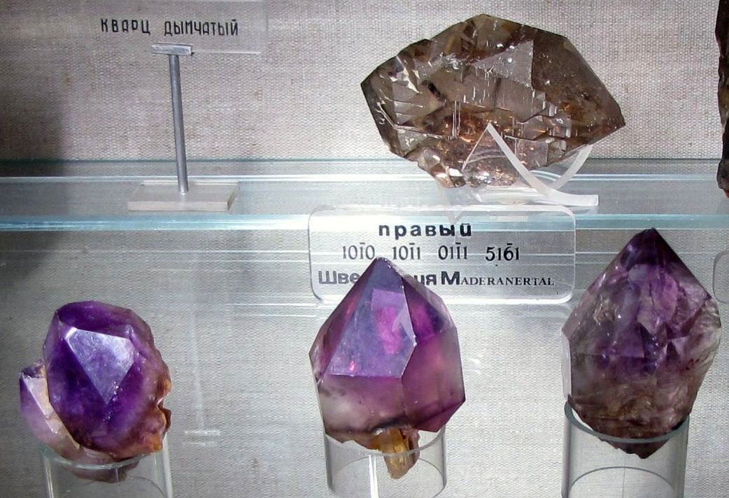
III order gemstones: turquoise, green and polychrome tourmalines, cordierite, spodumene (kunzite), dioptase, epidote, rock crystal, smoky quartz (rauchtopaz), light amethyst, carnelian, heliotrope, chrysoprase, semi-opal, agate, feldspars (sunstone , moonstone), sodalite, prehnite, andalusite, diopside, hematite (bloodstone), pyrite, rutile, amber, jet. Only rare species and specimens have a high cost. Many of them are so-called semi-precious in terms of their use and value.
The Urals have long amazed researchers with the abundance of minerals and its main wealth - minerals. There is so much to be found in the underground storerooms of the Urals! Extraordinary-sized hexagonal rock crystals, amazing amethysts, rubies, sapphires, topazes, wonderful jaspers, red tourmaline, the beauty and pride of the Urals - green emerald, which is valued several times more than gold.
The most “mineral” place in the region is Ilmen, where more than 260 minerals and 70 rocks were discovered. About 20 minerals were discovered here for the first time in the world. The Ilmen Mountains are a real mineralogical museum. Here you can find such precious stones as: sapphire, ruby, diamond, etc., semi-precious stones: amazonite, hyacinth, amethyst, opal, topaz, granite, malachite, corundum, jasper, sun, moon and Arabic stone, rock crystal, etc. .d.
Rock crystal, colorless, transparent, usually chemically pure, almost without impurities, is a type of low-temperature modification of quartz - SiO2, crystallizing in the trigonal system with a hardness of 7 and a density of 2.65 g / cm 3. The word “crystal” itself comes from the Greek word “krystallos”, which means “ice”. Scientists of antiquity, starting with Aristotle and including the famous Pliny, were convinced that “in the fierce Alpine winter, ice turns into stone. The sun is then unable to melt such a stone...”. And not only the appearance, but also the ability to always remain cool contributed to the fact that this opinion lasted in science until the end of the 18th century, when the physicist Robert Boyle proved that ice and crystal are completely different substances by measuring the specific gravity of both. The internal structure of ROCK CRYSTAL is often complicated by twin intergrowths, which significantly worsen its piezoelectric homogeneity. Large pure single crystals are rare, mainly in the voids and cracks of metamorphic shales, in the voids of hydrothermal veins of various types, as well as in chamber pegmatites. Homogeneous transparent single crystals are the most valuable technical raw material for optical instruments (spectrograph prisms, lenses for ultraviolet optics, etc.) and piezoelectric products in electrical and radio engineering.
Rock crystal is also used for the manufacture of quartz glass (low-grade raw material), in artistic stone-cutting and for jewelry. Rock crystal deposits in Russia are concentrated mainly in the Urals. The name emerald comes from the Greek smaragdos or green stone. In ancient Rus' it is known as smaragd. Emerald occupies a privileged place among precious stones; it has been known since ancient times and was used both as decoration and in religious rites.
Emerald is a variety of beryl, a silicate of aluminum and beryllium. Emerald crystals belong to the hexagonal system. The emerald owes its green color to chromium ions, which replaced some of the aluminum ions in the crystal lattice. This gemstone is rarely found in the form of flawless crystals; as a rule, emerald crystals are severely damaged. Known and valued since antiquity, it is used for inserts into the most expensive jewelry, usually processed with a step cut, one of the varieties of which is called emerald.
Quite a few very large emeralds are known that have received individual names and have been preserved in their original form, although the largest known weighing 28,200 g, or 141,000 carats, found in Brazil in 1974, as well as one found in South Africa weighing 4800 g, or 24,000 carats, were sawn and faceted for inserts into jewelry.
In ancient times, emeralds were mined mainly in Egypt, in the mines of Cleopatra. Precious stones from this mine ended up in the treasuries of the richest rulers of the ancient world. It is believed that the Queen of Sheba adored emeralds. There is also a legend that Emperor Nero watched gladiator battles through emerald lenses.
Emeralds of much better quality than the stones from Egypt were found in dark mica schists along with other beryllium minerals - chrysoberyl and phenacite on the eastern slope of the Ural Mountains near the Tokovaya River, approximately 80 km east of Yekaterinburg. The deposit was accidentally discovered by a peasant in 1830, after noticing several green stones among the roots of a fallen tree. Emerald is one of the stones associated with the Supreme Spirit. It is believed that it brings happiness only to a pure but illiterate person. The ancient Arabs believed that a person who wears an emerald does not have terrible dreams. In addition, the stone strengthens the heart, eliminates troubles, has a beneficial effect on vision, and protects against seizures and evil spirits.
In ancient times, emerald was considered a powerful talisman of mothers and sailors. If you look at a stone for a long time, then in it, like in a mirror, you can see everything secret and discover the future. This stone is credited with a connection with the subconscious, the ability to turn dreams into reality, penetrate secret thoughts, and was used as a remedy for poisonous snake bites. It was called the “stone of the mysterious Isis” - the goddess of life and health, the patroness of fertility and motherhood. He acted as a symbol of the beauty of nature. The special protective properties of emerald are an active fight against the deceit and infidelity of its owner. If the stone cannot resist evil qualities, it may break.
Diamond is a mineral, a native element, found in the form of eight- and twelve-sided crystals (often with rounded edges) and their parts. Diamond is found not only in the form of crystals, it forms intergrowths and aggregates, among which there are: bead - fine-grained intergrowths, ballas - spherical aggregates, carbonado - very fine-grained black aggregates. The name of the diamond comes from the Greek "adamas" or irresistible, indestructible. The extraordinary properties of this stone have given rise to many legends. The ability to bring good luck is just one of the countless properties attributed to diamonds. Diamond has always been considered the stone of winners; it was the talisman of Julius Caesar, Louis IV and Napoleon. Diamonds first came to Europe in the 5th-6th centuries BC. At the same time, diamond gained its popularity as a precious stone relatively recently, only five hundred and a half years ago, when people learned to cut it. The first semblance of a diamond was owned by Karl the Bold, who simply adored diamonds.
Today, the classic brilliant cut has 57 facets, and provides the famous “game” of the diamond. Usually colorless or painted in pale shades of yellow, brown, gray, green, pink, extremely rarely black. Brightly colored transparent crystals are considered unique, given individual names and described in great detail. Diamond is similar to many colorless minerals - quartz, topaz, zircon, which are often used as its imitations. It is distinguished by its hardness - it is the hardest of natural materials (on the Mohs scale), optical properties, transparency for X-rays, luminosity in X-rays, cathode, ultraviolet rays.
Ruby gets its name from the Latin rubeus, meaning red. The ancient Russian names for the stone are yakhont and carbuncle. The color of rubies varies from deep pink to deep red with a purple tint. The most highly valued among rubies are the “pigeon’s blood” colored stones.
Ruby is a transparent variety of the mineral corundum, an aluminum oxide. The color of ruby is red, bright red, dark red or violet red. The hardness of the ruby is 9, the luster is glassy.
The first information about these beautiful stones dates back to the 4th century BC and is found in Indian and Burmese chronicles. In the Roman Empire, the ruby was extremely revered, and was valued much higher than the diamond. In different centuries, Cleopatra, Messalina and Maria Stuart became connoisseurs of rubies, and the ruby collections of Cardinal Richelieu and Marie de Medici were once famous throughout Europe.
Ruby is recommended for paralysis, anemia, inflammation, fractures and pain in joints and bone tissue, asthma, weakness of the heart, rheumatic heart disease, inflammation of the pericardial sac, inflammation of the middle ear, chronic depression, insomnia, arthritis, diseases of the spine, chronic inflammation of the tonsils, rheumatism. Ruby lowers blood pressure and helps cure psoriasis. Helps with exhaustion of the nervous system, relieves night terrors, helps with epilepsy. Has a tonic effect.
Flora and fauna of the Urals
The flora and fauna of the Urals is diverse, but has much in common with the fauna of the neighboring plains. However, mountainous terrain increases this diversity, causing the appearance of altitudinal zones in the Urals and creating differences between the eastern and western slopes.
Glaciation had a great influence on the vegetation of the Urals. Before glaciation, more heat-loving flora grew in the Urals: oak, beech, hornbeam, and hazel. Remains of this flora are preserved only on the western slope of the Southern Urals. As you move south, the altitudinal zonation of the Urals becomes more complex. Gradually, the boundaries of the belts rise higher and higher along the slopes, and in their lower part, when moving to a more southern zone, a new belt appears.
To the south of the Arctic Circle, larch predominates in the forests. As it moves south, it gradually rises along the mountain slopes, forming the upper boundary of the forest belt. Larch is joined by spruce, cedar, and birch. Near Mount Narodnaya, pine and fir are found in the forests. These forests are located mainly on podzolic soils. There are a lot of blueberries in the grass cover of these forests.
The fauna of the Ural taiga is much richer than the fauna of the tundra. Elk, wolverine, sable, squirrel, chipmunk, weasel, flying squirrel, brown bear, reindeer, ermine, and weasel live here. Otters and beavers are found along the river valleys. New valuable animals have been settled in the Urals. The sika deer was successfully acclimatized in the Ilmensky Nature Reserve; muskrat, beaver, deer, muskrat, raccoon dog, American mink, and Barguzin sable were also resettled.
In the Urals, according to differences in altitude and climatic conditions, several parts are distinguished:
Polar Urals.
The mountain tundra presents a harsh picture of stone placers - kurums, rocks and outcrops. Plants do not create a continuous cover. Lichens, perennial grasses, and creeping shrubs grow on tundra-gley soils. The fauna is represented by arctic fox, lemming, white owl. Reindeer, white hare, partridge, wolf, ermine, and weasel live in both the tundra and forest zones.
The Subpolar Urals are distinguished by the highest ridge heights. Traces of ancient glaciation are more clearly visible here than in the Polar Urals. On the mountain ridges there are stone seas and mountain tundra, which gives way to mountain taiga lower down the slopes. The southern border of the Subpolar Urals coincides with 64 0 N latitude. A natural national park has been formed on the western slope of the Subpolar Urals and adjacent areas of the Northern Urals.
The Northern Urals do not have modern glaciers; It is dominated by medium-high mountains, the mountain slopes are covered with taiga.
The Middle Urals are represented by dark coniferous taiga, which is replaced by mixed forests in the south and linden tracts in the southwest. The Middle Urals are the kingdom of mountain taiga. It is covered with dark coniferous spruce and fir forests. Below 500 - 300 m they are replaced by larch and pine, in the undergrowth of which grow rowan, bird cherry, viburnum, elderberry, and honeysuckle.
The Southern Urals are the most diverse in natural conditions. Here lies the border of two natural zones - forest and steppe. Altitudinal zones are more represented - from steppes to alpine tundras.
Natural uniques of the Urals
1. Ilmensky ridge. The greatest height is 748 meters, it is unique for the richness of its subsoil. Among the nearly 200 different minerals found here, there are rare and rare ones not found anywhere else in the world. To protect them, a mineralogical reserve was created here back in 1920. Since 1935 this reserve has become comprehensive; now all nature is protected in the Ilmensky Reserve.
2. Kungur Ice Cave is a magnificent creation of nature. This is one of the largest caves in our country. It is located on the outskirts of the small industrial city of Kungur, on the right bank of the Sylva River, in the depths of a stone mass - Ice Mountain. The cave has four tiers of passages. It was formed in the thickness of rocks as a result of the activity of groundwater, which dissolved and carried away gypsum and anhydrite. The total length of all 58 surveyed grottoes and transitions between them exceeds 5 km.
Ecological problems:
1) The Urals is a leader in environmental pollution (48% - mercury emissions, 40% - chlorine compounds).
2) Of the 37 polluting cities in Russia, 11 are located in the Urals.
3) Man-made deserts have formed around 20 cities.
4) 1/3 of rivers are devoid of biological life.
5) Every year 1 billion tons of rocks are extracted, of which 80% goes to waste.
6) A special danger is radiation pollution (Chelyabinsk-65 - plutonium production).
There was a wary silence in the round hall of the Presidium of the USSR Academy of Sciences. The chairman of the newborn academic Ural Scientific Center, academician Sergei Vasilyevich Vonsovsky, represented the science of his region: a whole division of researchers - 30 thousand people, of which more than two dozen members of the academy, 500 doctors and 5 thousand candidates of science. The government acted farsightedly. It’s enough for the scientific Urals to be considered “sons”, or, speaking in Latin, to be a branch. Now it itself has become a center uniting forty universities and 227 (two hundred twenty-seven!) research institutions. In a word, a big ship has a long voyage.
But as to where the ship should sail, opinions in the room were divided. “Only applied work, searching for minerals,” some said, “after all, the Ural subsoil no longer provides the Ural industry.” “No,” the opponents objected, “the search cannot be conducted blindly. We need fundamental research that will restore the history of the formation of the Ural Mountains.” “But the Urals have been studied almost better than any other region of the globe. All the main geological theories were tested on the Ural touchstone...”
- So, the damned Volga still flows into the Caspian Sea? — my classmate at Moscow State University, now an assistant professor, beckoned me into the corridor. - Hide the notebook. This dispute, let it be known to you, is meaningless: there are no Ural Mountains anyway.
Without giving me time to come to my senses, the assistant professor pulled me towards the map.
“Of course,” he continued, “any student in my exam can say that the Urals are a mountainous country stretching from the Kara Sea to Mugodzhary, which separates the Russian Plain and the West Siberian Lowland - I will be forced to give him an A.” This is the tradition, although it is still not good to deceive babies... You, my brother at Moscow State University, must know the truth. Let's look north; some continue the Ural ridge on Novaya Zemlya, others turn it to Taimyr, and others drown it in the Kara Sea. What's in the south? Mugodzhary is not at all the southern tip of the Urals, the mountains continue, but no one knows where - either they stretch to the Tien Shan, or end at Mangyshlak. The story is the same with the western and eastern borders...
- But the Ural ridge still exists!
- Hm... The luminary of geology of the last century, Impey Murchison, argued that the Urals mountains have western and eastern slopes. Hundreds of researchers have been repeating this for many years, although they know very well that, for example, in Sverdlovsk there is no watershed. The Chusovaya River calmly flows through the center line from the eastern “slope” to the western, violating all the “scientific principles” of Murchison and his followers... That’s it. And if we consider the Urals as a geological concept, then it is generally unclear whether it stretches from north to south or from east to west and whether this ridge exists in nature.
- Well, you know!
- And you go to Sverdlovsk and see everything for yourself. There is a revolution in geology now, and its epicenter is in the Urals. Now this is happening there... From there we can see the future of the Ural center, and the future of geology itself, and the future of everyday practice itself.
In Sverdlovsk they argue about the oceans
Sverdlovsk is one of the most “land” cities on the planet. And not only because the Iset River cannot be reached to any sea: it is repeatedly blocked by dams within the city. Even Neptune's breath does not reach here. The Pacific Ocean is too far away, the Atlantic wind weakens long before the Urals. You can feel the proximity of the Arctic, but it is no longer a water basin, but an icy country. In general, where is the sea, and where is Sverdlovsk...
And yet, the biggest event of the young scientific center in the summer of 1971 was precisely the discussion about the ocean. One respected Moscow academician has just returned from a voyage on the Vityaz. He brought with him samples of the Earth's mysterious mantle.
The scientists took their places in the spacious hall: the venerable ones were closer to the podium, the young ones were behind.
— They are preparing for a discussion as if for a battle. They even take up places like fighting positions - “mobilists” on the left, “fixists” on the right,” whispered a young Sverdlovsk geologist I knew.
- Where should the speaker sit then?
- On the left. He was already sitting on the right. You see, for a very long time geology was a science not about the whole earth, but only about the land. Recently, major discoveries have been made in the ocean. We had to reconsider old concepts and put forward new hypotheses. “Mobilism” was revived, but on a new basis.
- Who are you for? Which hypothesis is closer to you?
Instead of answering, the geologist took me to the wall newspaper “Earth”. Crossed out in red pencil, there was the inscription: “A hypothesis is an attempt to turn a problem from its head to its feet, without first establishing where its “legs” are and where its “head” is.” By hanging their wall newspaper next to the announcement of the lecture, the young geophysicists apparently sought to inject something of KVN into the discussion. “Every lowland strives to become a highland, and this is a real natural disaster.” Perhaps, this is not only about the earth’s surface... But, it seems, a pin for some of the venerable: “It’s not enough to be Magellan. There must be somewhere the Strait of Magellan that you discovered.”
— Take a closer look, next to you is the main opponent of today’s speaker...
The opponent skimmed the aphorism: “You don’t have to be a fossil to be useful.” Thought about it. Then another one: “All forces on earth are opposed by one and only one - the force of inertia.”
“Well, without resistance there is no movement forward,” he smiled at my interlocutor.
It depends on everyone, but I liked this attitude of the young center.
A person who comes to a scientific debate for the first time sometimes feels uneasy. He often cannot even understand what we are talking about and where, in fact, the dispute is. There are reports, questions are asked, and there seems to be no boiling of passions, and the “drama of ideas” is also not noticeable. But this is only in the eyes of the uninitiated...
What do people rushing to a debate expect first of all? Of course, facts. But the new data themselves, oddly enough, do not solve much. Facts are like bricks from which you can build a hut and a palace. And now the discussions are rapidly accelerating the pace of laying out the facts. This is their great meaning: in a comprehensive, critical examination of both the facts themselves and their placement in the building of new hypotheses and theories.
The Ural, as everyone knows, is a jewelry box. They say that one professor, asking during an exam where there are deposits of such and such a mineral, immediately added: “Except for the Urals, of course...”
The Urals have long been the backbone of our industry, and even now its importance is enormous. The source of this power of the Urals is its bowels. But their wealth no longer meets the needs of even the Urals itself. Has the treasury become depleted? No, this is more likely something else. What was discovered was relatively easy to discover, and what was more difficult was difficult to discover. Largely because the laws of the formation and placement of ores in the depths of the earth, and in the Urals in particular, are still not fully understood.
How can they be understood if they argue about how the Urals itself arose?
Previously, at least, “everything was clear”: the Urals arose in the place where it is located to this day - in the middle of Eurasia when folds of the earth’s crust were crushed. And now this most important fact for both theory and practice has been called into question...
That was the point of view of the fixists - the Urals are located where they arose. But if until recently the hypothesis of mobilism - the movement of continents - was considered a kind of “geological exoticism”, then in recent years the study of the ocean floor has provided strong arguments in its favor (See Around the World No. 10, 1971.). And the past of the Urals found itself at the center of such controversy as has not been seen in geology for a long time.
Let me remind you that, according to mobilists, many hundreds of millions of years ago there was one continent on Earth, Pangea, and one ocean, Tethys. Pangea then split into Laurasia and Gondwana, which in turn gave rise to modern continents. The “debris” of Pangea drifted along the surface of the mantle, like ice floes, and the Urals owes its birth to the collision of two such “debris”: the subcontinents of Siberia and Russia.
As I already said, to the summer discussion in Sverdlovsk the Moscow guests brought with them samples of the Earth’s mantle obtained from the bottom of the ocean. Black stones, somewhat reminiscent of lunar rocks, went from hand to hand. You should have seen how they were viewed!
They examined and compared them with those rocks of the Urals, which are also, quite possibly, rocks of the mantle.
But the mantle does not reach the surface of the Earth anywhere! Not a single deepest well reached its surface! The mantle is still hidden by the impenetrable thickness of the earth's crust! Where did oceanic samples of the mantle come from and how did rocks of the same mantle end up in the Urals? In general, why so much attention to the mantle and what does the ocean have to do with it?
World dunite problem
There was such a case in the life of the great chemist D.I. Mendeleev: he was able to unravel one carefully guarded production secret by analyzing what cargoes arrived at the plant.
The “factory” where mineral deposits are “produced” is not yet accessible to the human eye - as a rule, the processes took place and are going on in the depths of the earth’s crust and, apparently, to an even greater extent, in the mantle.
“You see, no one has seen the mantle,” I summarize what the Ural geologists told me. “So it’s hard to say what we’re looking for.” The oldest breed? Perhaps the Substrate from which most minerals are born? Of course, this is our main goal. The answer will be provided by deep drilling into the mantle; it is already underway on the continents and in the ocean. Strictly speaking, we do not yet have samples of the original mantle. We are content with samples from the deepest oceanic depressions and their “relatives”, which in the Urals, although not only in the Urals, come directly to the surface. They are called dunites.
I remembered the engineer Garin, who with his hyperboloid made a way into the olivine belt of the Earth, under which an ocean of gold boiled. Garin, like us, was attracted by the mysterious substance of the mantle. (Dunite, by the way, consists mainly of olivine.)
— The samples delivered by Vityaz and the Ural dunites are rejects of the mantle. It is necessary to judge the deep substrate from them with the same caution with which we draw conclusions about the lifestyle of these fish from the corpses of deep-sea fish torn apart by pressure. And yet, dunites are already a bird in the hands.
While exploring platinum-bearing massifs, geologists became convinced that dunites emerge from the depths in the form of pipes. In addition, these continental rocks and those found on the ocean floor are certainly related. So, maybe we really are holding in our hands a piece of the pie from that hellish kitchen where nature “cooks” minerals?
The approaching revolution in geology is not only a revision of the position on the inviolability of continents. Until recently, there seemed to be no doubt that dunites were generated by the fiery melt of the Earth - magma (of course: such deep rocks - how could they not be the offspring of magma!). It turned out, however, that the dunites were never liquid or hot.
“It was completely incomprehensible,” writes the director of the Institute of Geology of the Ural Scientific Center, corresponding member of the USSR Academy of Sciences S.N. Ivanov, “how such heavy and refractory rocks could rise in molten form from the bowels of the Earth and at the same time not have a noticeable thermal effect on the surrounding thickness. Now we can assume that what we have in front of us is not frozen magma, but fragments of the Earth’s upper mantle, which once lay under the ocean, and then were pushed in the form of giant scales onto younger sediments, crushed into mountain structures.”
So this is why land geologists need ocean science! Knowing the tectonic history of the region, they could be guided by a compass that would indicate the shortest path to the as yet unknown riches of the subsoil.
“Kitchen of metals”, or maybe an alchemist’s laboratory
When it was thought that an ocean of magma lay beneath the layers of the earth, the birth of metal ores was considered by analogy with the processes of metallurgy. But even under volcanoes there is no liquid and hot ocean - just small lakes. The path to the truth turned out to be longer, more complex and confusing than expected.
Fossil deposits are the result of very long transformations. It would seem that these are “living” cracks in the earth, volcanic outlets through which fluids rise—gas-saturated ore solutions. Alas, they do not reach the surface, and the geologist is forced to judge the processes that take place in the depths, like a cook about food, by smelling its smell.
And yet, having presumably explained the structure of the “earthly cauldron,” it is easier to understand how food is “cooked” in it. Thus, S.N. Ivanov believes that ore arises from deep fluid, but this happens differently under the oceans and under the continents. The first case involves locally emerging juvenile, virgin magma, and often mantle rocks. The process takes place under the yoke of a powerful water press. The ore-bearing fluid dumps its burden where the pressure weakens. More often this happens not in the main faults of the earth's crust, but in the lateral feathering cracks, where the pressure is somewhat less. Perhaps, in the oceans under these conditions, part of the fluid enters directly into the water and, as a result, the ocean bed becomes poorer in deposits? Is this why there are so many salts dissolved in sea water? And doesn’t this mean that the continents are richer in “solid ores”?
D.I. Mendeleev said that it is better to use a hypothesis, which may later turn out to be incorrect, than not to have any at all.
While exploring the subsoil, Sverdlovsk scientist Professor N.D. Budanov showed particular interest in “living” seams, rifts, faults, craters - all those passages that lead into the depths. Some data from the Ural and world geology led him to the assumption: could the intersections of deep cracks be those “exits from the underworld” through which ores and minerals are released into the white light?
Until recently, any student could object to the professor that even if this hypothesis is correct, then it is irrelevant for the Urals and cannot help search engines in any way. The intersection of uplifts, he would quote V.A. Obruchev himself, is recognized only by researchers of the old school, and “modern geology no longer allows that a section of the earth’s crust... which has undergone intense folding dislocation in one direction, could, under the influence of pressure from another direction, change its original folding." Simply put, this is what it meant. The Ural Mountains are an ancient fold of the earth's crust that stretches along the meridian. Transverse and latitudinal folds should not occur in the Urals.
Geophysicists were the first to disagree with this. Already about thirty years ago they noticed that seismic waves propagate better just across the Urals. Conducted magnetic survey of depths. What is it, a ridge clearly appeared on the maps, going from the city of Kirov somewhere to the east! The last word in this study fell to the most silent witnesses - the stones. The amphibolite, pulled out from the depths, turned out to be of a very respectable age - 1.5 billion years old. Analysis showed that it was born not from magma, but from the ocean. The same ancient reservoir that was on the site of the Urals.
This is how the buried Biarmeisky ridge was discovered, or, as it is also called, the Third Ural (the second, trans-Ural, ridge is buried in the east of the modern ridge). And along with it, those very transverse cracks and “living” seams that are needed to explain how deposits are formed in the Urals gained citizenship in science.
But what is it like, this “well-studied” Ural? In addition to the visible, it means that there is also an “invisible” Urals, and this is not a meridional ridge, but a latitudinal-meridional one, and most likely not even a ridge, but a combination of ridges... “Come on, is there a ridge itself?” — I remembered the words of my Moscow friend.
If there is a tree, then there are roots. It was believed that in relation to mountains this is as true as for trees: elevations above the surface should correspond to depressions under the surface, the mighty “roots” of the ridges. And here is the last discovery, or rather “closure”: the Urals do not have any such special “mountain roots”. Seismic studies have shown that the thickness of the earth's crust under the Urals is the same as in the Moscow region! There is depression, but it is insignificant - 3-6 kilometers, with a crustal thickness of 38-40 kilometers; in fact, both the plain and the Ural ridge lie on the same base! This overturns many “geological foundations”, it contradicts... you have to be a geologist to understand what a blow this is to previous theories.
So, perhaps the Urals are a crumple that arose at the junction of two subcontinents; So, there are several “Urals” - there is the meridional ridge familiar to us, and there are latitudinal, buried ridges; So, this mountainous country does not have a trough immersed in the mantle, as mountainous countries are supposed to do; So, features can be traced that apparently make the continental Urals similar to the products of the ocean...
When a fast current hits an obstacle, its jets fan out in search of a way out. Human thought behaves in exactly the same way. How wide the “scatter” of hypotheses is in world geology in general and in the Urals in particular can be illustrated by Budanov’s views on the source of the formation of ores and minerals.
Are the minerals that we find close to the surface the same throughout the planet? Of course not; There is every reason to think that closer to the Earth’s core the pressure is so great that there are no chemical elements familiar to us at all: the shells of electrons are pressed into the nuclei of atoms there. There is no iron, no copper, no gold. And yet they are there, because that is where they come from. Paradox, isn't it?
How do they come about anyway? Professor Budanov believes that this process cannot occur without nuclear transformations, that our Earth is a powerful nuclear reactor, where some elements are transformed into others.
This is the extreme point, far removed from all others, of the “fan” of ideas that is now unfolding in the Urals. The humorous wall newspaper uniquely but accurately reflects the spirit of search, reflection, and doubt that has established itself within the walls of the new scientific center.
What will happen
I said: “Within the walls of the new scientific center.” But this is a tribute to literature. These walls don't exist yet. There are walls of the former institutes of Sverdlovsk, but new ones, especially for the scientific center, have yet to be erected. How urgent this task is is shown by the fact that the construction of the Ural Scientific Center has been declared a major Komsomol construction project. The problems facing Ural science are too great and urgent. As we see, there are people, there is experience, there are the most interesting, although sometimes dizzying ideas, there is a spirit of impatient search - we need new laboratories, equipment, equipment. The strategic plan by which the new science center will live is more extensive than these notes might suggest. Research of terrestrial magnetism - in Sverdlovsk there is a leading scientific school in this field, headed by Academician S.V. Vonsovsky. Nuclear logging is a new method of “scanning” the earth’s interior (the method is new, but in the Urals it is being developed by the oldest geophysical station in the country). Karst research - in the Urals, in Kungur, there is the only hospital in the world that deals with this; his research helps, for example, to ensure the stability of the dam on the Kama. These, like many other areas, were in the pipeline. But now the country’s first Institute of Ecology has been created - the Ural Scientific Center will not live by geology alone. In the laboratory of the Institute of Geology, with the help of ultra-high pressures, the conditions of the earth’s depths are simulated, that is, the conditions of the “kitchen” where nature creates minerals and ores are recreated (drilling by drilling, hypotheses by hypotheses, and some things can already be experimented with!). There's more... But that's enough, perhaps.
Before leaving Sverdlovsk, I again approached the wall newspaper of geophysicists. There was a new drawing. A gray-haired academician walks along the Ural meridian, somewhat similar to Effel’s god; and on the sides stand Neptune, Vulcan, Pluto, and each beckons the scientist to himself. And it seems that the scientist is taking a step towards Neptune. But at the same time, he smiles friendly at his colleagues on Olympus...
The current situation in geology is outlined here with enviable accuracy. In the geosciences, a genuine revolution is maturing and, perhaps, even underway. The Ural Scientific Center arose at an interesting time...
Are the Himalayas an analogue of the Urals?
The problem of the origin of the Urals is of interest not only to Soviet but also to foreign geologists, as evidenced, for example, by the recent hypothesis of Dr. Hamilton (USA). After analyzing the available data, Hamilton became convinced that the Russian and Siberian subcontinents 550 million years ago were apparently at a considerable distance from each other. Their collision occurred much later, about 225 million years ago. Moreover, the formation of the Urals was the result of a process more complex than simply the “creeping” of the edges of two subcontinents.
Hamilton believes that the Russian subcontinent possessed an island arc separated from its edge by an oceanic basin. However, subsequently the earth's crust under this basin began to go deeper. Approximately the same absorption of crustal areas took place in the region of the Siberian subcontinent. Ultimately, the island arcs and subcontinents “fused together”, giving rise to the Ural Range. The deformation, however, did not end there, which makes it even more difficult to decipher the structure of the Urals.
The researcher believes that his hypothesis is applicable to the study of all mountain structures similar to the Urals. From these positions, he, in particular, has now begun to reassess the history of the formation of the Himalayas.
A. Kharkovsky, our specialist. corr.
Ural Mountains- a unique natural object for our country. You probably shouldn’t think too hard to answer the question why. The Ural Mountains are the only mountain range that crosses Russia from north to south, and are the border between two parts of the world and the two largest parts (macroregions) of our country - European and Asian.
Geographical location of the Ural Mountains
The Ural Mountains stretch from north to south, mainly along the 60th meridian. In the north they bend towards the northeast, towards the Yamal Peninsula, in the south they turn towards the southwest. One of their features is that the mountainous area expands as you move from north to south (this is clearly visible on the map on the right). In the very south, in the region of the Orenburg region, the Ural Mountains connect with nearby elevations, such as General Syrt.
No matter how strange it may seem, the exact geological border of the Ural Mountains (and therefore the exact geographical border between Europe and Asia) still cannot be accurately determined.
The Ural Mountains are conventionally divided into five regions: Polar Urals, Subpolar Urals, Northern Urals, Middle Urals and Southern Urals.
To one degree or another, part of the Ural Mountains is captured by the following regions (from north to south): Arkhangelsk region, Komi Republic, Yamalo-Nenets Autonomous Okrug, Khanty-Mansiysk Autonomous Okrug, Perm Territory, Sverdlovsk Region, Chelyabinsk Region, Bashkortostan Republic, Orenburg Region , as well as part of Kazakhstan.
Origin of the Ural Mountains
The Ural Mountains have a long and complex history. It begins back in the Proterozoic era - such an ancient and little-studied stage in the history of our planet that scientists do not even divide it into periods and eras. About 3.5 billion years ago, at the site of the future mountains, a rupture of the earth's crust occurred, which soon reached a depth of more than ten kilometers. Over the course of almost two billion years, this rift widened, so that about 430 million years ago an entire ocean, up to a thousand kilometers wide, was formed. However, soon after this, the convergence of lithospheric plates began; The ocean disappeared relatively quickly, and mountains formed in its place. This happened about 300 million years ago - this corresponds to the era of the so-called Hercynian folding.

New large uplifts in the Urals resumed only 30 million years ago, during which the Polar, Subpolar, Northern and Southern parts of the mountains were raised by almost a kilometer, and the Middle Urals by about 300-400 meters.
Currently, the Ural Mountains have stabilized - there are no major movements of the earth's crust observed here. However, to this day they remind people of their active history: from time to time earthquakes occur here, and very large ones (the strongest had an amplitude of 7 points and was recorded not so long ago - in 1914).
Features of the structure and relief of the Urals
From a geological point of view, the Ural Mountains are very complex. They are formed by rocks of various types and ages. In many ways, the features of the internal structure of the Urals are related to its history, for example, traces of deep faults and even sections of oceanic crust are still preserved.
The Ural Mountains are medium and low in height, the highest point is Mount Narodnaya in the Subpolar Urals, reaching 1895 meters. In profile, the Ural Mountains resemble a depression: the highest ridges are located in the north and south, and the middle part does not exceed 400-500 meters, so that when crossing the Middle Urals, you may not even notice the mountains.

View of the Main Ural Range in the Perm Territory. Photo by Yulia Vandysheva
We can say that the Ural Mountains were “unlucky” in terms of height: they were formed during the same period as Altai, but subsequently experienced much less strong uplifts. The result is that the highest point in Altai, Mount Belukha, reaches four and a half kilometers, and the Ural Mountains are more than two times lower. However, this “elevated” position of Altai turned into a danger of earthquakes - the Urals in this regard are much safer for life.

Typical vegetation of the mountain tundra belt in the Ural Mountains. The picture was taken on the slope of Mount Humboldt (Main Ural Range, Northern Urals) at an altitude of 1310 meters. Photo by Natalya Shmaenkova
The long, continuous struggle of volcanic forces against the forces of wind and water (in geography, the former are called endogenous, and the latter - exogenous) created a huge number of unique natural attractions in the Urals: rocks, caves and many others.
The Urals are also famous for their huge reserves of minerals of all types. These are, first of all, iron, copper, nickel, manganese and many other types of ores, building materials. The Kachkanar iron deposit is one of the largest in the country. Although the metal content in the ore is low, it contains rare but very valuable metals - manganese and vanadium.
In the north, in the Pechora coal basin, hard coal is mined. There are also precious metals in our region - gold, silver, platinum. Undoubtedly, Ural precious and semi-precious stones are widely known: emeralds mined near Yekaterinburg, diamonds, gems from the Murzinsky strip, and, of course, Ural malachite.
Unfortunately, many valuable old deposits have already been developed. The “Magnetic Mountains,” containing large reserves of iron ore, have been turned into quarries, and the reserves of malachite have been preserved only in museums and in the form of separate inclusions on the site of old mines - it is hardly possible to find even a three-hundred-kilogram monolith now. Nevertheless, these minerals largely ensured the economic power and glory of the Urals for centuries.
Text © Pavel Semin, 2011
website
Film about the Ural Mountains: